The community and the Shire values the natural environment and unique biodiversity of the region, and seeks to protect and enhance it for current and future generations.
Biodiversity
The Shire lies within the South West’s botanical province, which supports an estimated 8000 species of vascular plants, representing two thirds of the estimated species in Western Australia.
Over 80% of the plants in the South West are endemic to the province. These plants are not found anywhere else.
The Shire is part of the Busselton to Augusta National Biodiversity Hotspot and the International South West Hotspot.
Biodiversity hotspots:
- Acknowledge the exceptional concentration in diversity and endemism (that occur nowhere else) of species in an area
- Highlight the threats to this biodiversity as a result of the significant loss of habitat in these areas.
It is now estimated that within the shire there are:
- 6 Threatened Ecological Communities
- 59 Vegetation complexes including a significant number which are threatened
- 69 Declared Rare and Priority Flora species
- 28 Declared Threatened Fauna species.
Local Biodiversity Strategy
The Shire of Augusta Margaret River has developed a Local Biodiversity Strategy (LBS), which is a non-statutory document which provides a framework to foster community stewardship of local natural areas and guide biodiversity conservation management and initiatives in the Shire of Augusta Margaret River. The LBS has been developed through a collaborative consultation process with the community, stakeholders and Shire staff over a two-year period.
The Shire’s vision for the LBS is to implement a nature positive approach for best-practice planning and operations for biodiversity protection, supporting community, landholders and partnership initiatives. The LBS incorporates a Local Government Biodiversity Planning Guideline process for assessing and prioritising Local Natural Areas (LNAs). This framework assists the Shire to identify conservation priorities within Shire vested land. We also want to support and encourage landholders to protect and manage LNAs (remnant native vegetation areas) on their properties. The Strategy aims to focus management on the protection of high priority LNAs, working collaboratively on environmental initiatives with the community, landholders and partners, mainstreaming biodiversity in all Shire operations and creating a culture of stewardship towards the natural environment.
The Local Biodiversity Strategy is set out in two parts. Part 1 includes a summary of the purpose, vision, strategy framework, working with community, landholders and partners and action plan. Part 2 includes background technical investigations, maps and evaluation of local natural area values and prioritisation
The Local Biodiversity Strategy (LBS) is a plan developed by the Shire of Augusta Margaret River to guide the protection, enhancement and management of local natural areas across the Shire.
The aim of the LBS is to improve how biodiversity is considered in Shire operations and decision-making processes supporting community, landholders and partnership initiatives.
The aim of the LBS is to improve how biodiversity is considered in Shire operations and decision-making processes supporting community, landholders and partnership initiatives.
No. The LBS is not a formal policy or legal instrument, and does not affect or change any existing policies, plans or laws. It is a document that helps to guide operations and decision-making at the local government level.
Biodiversity is the diversity of life on earth and is critical to our region as it drives the ecosystems services that support our quality of life.
Protecting local biodiversity in the Shire of Augusta Margaret River is crucial, due to its unique ecological and cultural significance.
The region is part of the Southwest Australia biodiversity hotspot, one of only 36 such hotspots globally, known for its rich diversity of plant and animal species, many of which are endemic and are found nowhere else on Earth.
Regions are considered hotspots if they are unique and if that uniqueness is under threat. The threat to their survival is heightened by factors such as habitat loss, climate change, and invasive species.
The Shire of Augusta Margaret River is considered a potential biodiversity refuge. As climate conditions worsen with rising temperatures and declining rainfall, the cooler, wetter microclimates of the Capes region, including the forests and river systems, may provide critical havens for some species, including threatened species like the Western Ringtail Possum and Black Cockatoos.
The Shire delivers a range of critical services to the community, from infrastructure (roads, parks, waste management), planning and development to community services.
The Strategy helps guide how the Shire works to protect biodiversity, support ecological health, cultural values and climate resilience while delivering these services.
To help manage key threats to biodiversity – both current and emerging – the Strategy outlines an action plan for Shire staff and how we continue to work collaboratively with our community and partners.
The Local Biodiversity Strategy identifies opportunities for the Shire to work in partnership with stakeholders and the community to implement projects that protect and enhance biodiversity and our local natural areas.
It also considers ways of fostering community understanding, respect and stewardship for the environment through environmental education and engagement initiatives.
The Strategy will provide the agricultural community and landholders with potential opportunities to be involved in voluntary biodiversity initiatives such as strategic weed control, feral animal control, fencing of waterways or remnant vegetation.
It’s important to note that the strategy is not a formal policy or legal instrument and does not affect or change any existing policies, plans or laws. If your property falls within an area mapped in the strategy as an ecological linkage or priority local natural area, please be assured that there will be no changes to how you can use your land.
Biodiversity provides essential ecosystem services, including pollination, water purification, soil fertility, pest control, and climate regulation – all of which are essential for a healthy and resilient agricultural sector.
Protecting biodiversity aligns with the cultural values of the traditional Wadandi and Pibelmen custodians, whose connection to Wadandi/Pibelmen Boodja (land, country) emphasises the importance of safeguarding both the natural environment and the cultural landscapes.
The preservation of species, ecosystems and land features enhances cultural heritage, supporting the continuation of traditional practices and respect for the natural world.
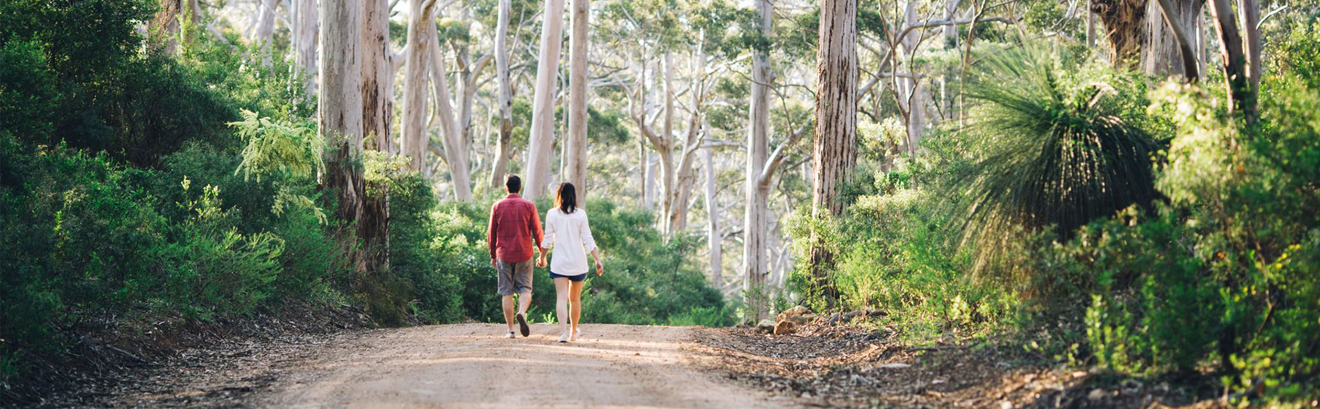
The Shire's natural attractions – from the towering Karri forests to the stunning beaches, surf breaks and the rugged cliffs and caves of the Leeuwin Naturaliste Ridge – offer immense value to residents and visitors alike.
Protecting these environments ensures the continued enjoyment of these outdoor activities, promoting well-being and supporting eco-tourism industries.
In 2022 WALGA applied for and received funding from the State Government under the State Natural Resource Management (NRM) Program for the project Local Government Biodiversity and Native Vegetation Management Project.
Through this project, WALGA made funding available to local governments to prepare their own local biodiversity strategies in line with well-established Local Biodiversity Planning guidelines.
The Shire was one of eight local governments in the south west region successful in receiving a grant from WALGA to support the development of a Local Biodiversity Strategy.
An ecological linkage refers to areas of connected and nearby patches of remnant vegetation. Ecological linkages act as ‘stepping stones’ through cleared areas, to allow for the movement of species (flora and fauna) to maintain ecological functions and biodiversity across the landscape.
Broad ecological linkages in the south west region of WA have been mapped by the WA Local Government Association and the Department of Environment and Conservation.
They collected publicly available spatial, geophysical, and ecological data held by the State Government, and undertook analysis and modelling to nominate where linkages exist at the regional scale.
If you’d like more information please refer to page 54 of the Strategy.
The map in the Strategy (Figure 12, page 55) shows where the ecological linkages are located throughout the Shire.
This Strategy has no impact on land use.
An objective in the Strategy is to improve the resilience of local natural areas by protecting and enhancing regional and local scale ecological linkages and corridors.
This could be done through investigating opportunities such as securing grant funding to collaborate with interested landholders and stakeholders to, for example, undertake weed control and/or revegetation along creekline areas.
Local natural areas are all natural areas containing remnant native vegetation, excluding existing DBCA managed lands. In the LBS, natural areas include remnant bushland on Shire-vested lands, other Crown Reserves, Unallocated Crown Land, Noongar Boodja Land, road reserves and private property.
Approximately 26% of land within the Shire is considered a Local Natural Area.
Some local natural areas are higher priority to protect than others. Identifying high priority areas for conservation is important for determining where resources should be directed.
The prioritisation process in the LBS is based on an established and widely accepted methodology developed by researchers (Del Marco et al. 2004). The prioritisation uses 28 conservation criteria to provide a score out of 58 for each local natural area. These criteria include factors such as:
- regional and local vegetation representation,
- rarity (e.g.Threatened and Priority flora and fauna),
- vegetation associated with wetlands or coastal dunes.
The criteria were weighted, with more critical ecological values, such as the presence of threatened flora, receiving higher scores.
The assessment was based on desktop mapping from publicly available government datasets only. There were no specific on-ground site assessments undertaken in the preparation of the Strategy.
These scores were then given a priority category from:
- Very Low (0-16),
- Moderate (17-29),
- Very High (>30-58).
The score achieved by each local natural area provides an indication of the number and importance of criteria being met, the potential for the area to be of conservation value and therefore its priority for action.
For more information, please refer to page 69 of the LBS.
Your property is an amazing biodiversity asset and we want to help you keep it that way. You may be contacted in the future by the Shire regarding voluntary landowner opportunities for grants, incentives or partnership projects to help you protect areas of remnant vegetation on your property.
It’s important to note that participation in these opportunities is voluntary, and the Strategy will not result in any changes to existing policies, plans or legislation around land use.
The LBS is not part of the statutory planning framework. As such it is not essential that planning decision makers give it ‘due regard’ in making decisions and it has not been designed for that purpose.
The mapping contained within the LBS has long been available to planning decision makers via other sources such as via State Government agencies.
Mapping and information of this type will continue to be referenced where helpful in decision making but will not determine outcomes.
The LBS includes a 10-year Action Plan, which is a list of recommended actions for the Shire to implement. The actions include:
- Protection of local natural areas
- Enhancement and management of local natural areas
- Protection and enhancement of strategic ecological linkages
- Working with partners
- Fostering community understanding, respect and stewardship for the environment
- Mainstreaming biodiversity in Shire operations and decision-making
Some of the actions in the LBS are ones that are already being implemented by the Shire, or are part of an ongoing program, which will continue. For example, the continuation of the Shire’s Environmental Management Fund (EMF) to support projects like the Lower Blackwood LCDC’s priority weed control subsidy for landholders, and Nature Conservation Margaret River Region’s school education program including Our Patch, Adopt a Spot, and Waatu Kaatijin.
Other actions are new and will require additional resourcing. These include the development of a series of Biodiversity Information Packs for residents, developing a guideline for the management of roadside native vegetation, and management plans for high priority local natural areas and ecological linkages on Shire-managed lands.
Threats to our natural areas
Threats to our natural areas arise from human and environmental factors such as fire, weeds, climate change and clearing for development.
Our goal and responsibility
The Shire has a responsibility to protect the environment through planning for the future and to proactively respond to key environmental issues.
The Shire is directly responsible for managing over 300 Reserves, containing over 3,300 ha of remnant vegetation and waterways. Many of these reserves contain very high environmental and social values.
Our goal is to:
- Increase the size of the natural areas in the Shire which have a high degree of protection
- Improve the quality of natural areas
- Identify and mitigate against risks to protected natural areas.
The Shire and partners have developed over 20 management plans for Shire reserves (see list below) that detail their unique values, threats and provide detailed recommendations to improve them.
- Barrett Street Reserve EMP 2011
- Molloy Island Land for Wildlife Plan 2012
- Granny James Reserve Land for Wildlife Plan 2012
- Lot 5176 Hillview Road (Augusta Golf Club) Plan 2012
- Reserve 30327 (Bessell Rd Rosa Brook) Action Plan 2012
- Reserve 37152 (Bessell Rd Rosa Brook) Action Plan 2012
- Reserve 39142 (Bramley River Rd Rosa Brook) Action Plan 2012
- Rosa Brook Reserves (Rosa Brook Rd) Action Plan 2012
- Riverslea Foreshore EMP 2014
- Witchcliffe Reserves Management Plan 2015
- Alexandra Bridge (Reserves 23480 and 38822) Reserve Action Plan 2016
- Alexandra Bridge Hall (Reserve 23973) Reserve Action Plan 2016
- East Augusta and Swan Lake (Reserves 39434 and 25211) Reserve Action Plan 2016
- Lower Margaret River Foreshore Action Plan 2018
- Brookfield Foreshore Reserve Action Plan 2018
- Brookfield Reserve Bushland Management Plan 2018
- Kevill Road East Bushland Management Plan 2018
- Cowaramup Bay Management Plan 2019
- Redman Brook Management Plan 2020
- Gnarabup Prevelly Foreshore Management Plan 2022.
The Shire works with volunteers and partners to manage our environment including implement large scale revegetation, weed control and access control. We also provide funding to community groups to undertake works.
To learn more contact the Shire environment team on [email protected]
Strategic planning for new urban growth areas
The Shire’s strategic planning for new urban growth areas has placed high importance on the retention of natural bushland and has specifically identified predominantly cleared areas for development purposes.
Through the Subdivision and Conservation Policy (see below), the Shire offers a considerable subdivision incentive for landowners to arrange for a conservation covenant to be applied to native bushland on their property, thus protecting it and putting in place a plan for its management.
How can you help?
- When walking in nature, stick to paths where possible, to avoid the spread of dieback
- Keep your pet cats indoors at night time
- Keep your pet dog(s) on leads and out of national parks
- Incorporate local native vegetation into landscaping
- Join a friends or community environmental group such as the Nature Conservation or the Lower Blackwood Catchment group.